Trails for everyone, forever

Home Go Hiking Hiking Guide Surprise Lake

Help power WTA's essential work for trails and hikers. GiveBIG on May 7-8 or by making an early gift today. Thank you for your generosity!


link

Surprise Lake

Mount Rainier Area > NW - Carbon River/Mowich
47.0236, -121.8609 Map & Directions
Length
4.0 miles, roundtrip
Elevation Gain
1,444 feet
Highest Point
4,435 feet
Calculated Difficulty About Calculated Difficulty
Moderate
Surprise Lake. Photo from WTA archives.
  • Dogs allowed on leash
  • Established campsites
  • Lakes
  • Mountain views
  • Waterfalls

Parking Pass/Entry Fee

None
Saved to My Backpack

Surprise Lake and the surrounding land is entirely on private property. The road to the lake is gated, but kept open to hikers by the property owners. To retain access to this lovely lake, please respect the private property and refrain from entering any structures you may encounter on your outing. Continue reading

Rating
4.00 out of 5

Hiking Surprise Lake

Surprise Lake and the surrounding land is entirely on private property. The road to the lake is gated, but kept open to hikers by the property owners. To retain access to this lovely lake, please respect the private property and refrain from entering any structures you may encounter on your outing.

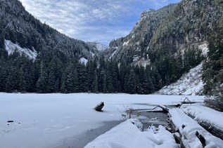
 The two-mile hike to Surprise Lake follows a Forest Service road for its entirety. You'll pass creeks and through forests with the occasional view of the valley before arriving at the lake. 

WTA worked here in 2022!

Surprise Lake

Map & Directions

Trailhead
Co-ordinates: 47.0236, -121.8609 Open in Google Maps

Before You Go

See weather forecast

Parking Pass/Entry Fee

None

WTA Pro Tip: Save a copy of our directions before you leave! App-based driving directions aren't always accurate and data connections may be unreliable as you drive to the trailhead.

Getting There

Head out to Highway 410, then make a left on Highway 165, just before entering the Carbon Glacier entrance to the park turn left onto NF-7810. NF-7810 is a bridge that crosses the Carbon River.

Head up the gravel road for about 3.5 miles. Park to the side of NF-7810 near NF-7840. Trail begins on the left side of the road heading up.

More Hike Details

Trailhead

Mount Rainier Area > NW - Carbon River/Mowich

Private Land

You can improve or add to this guidebook entry!

Surprise Lake

17 Trip Reports

Hiked here recently?

Submit a trip report!
 
Trip Reports