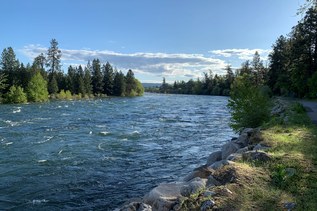
Fish Park is a 40-acre park just north of downtown Poulsbo with a wonderful network of trails that run along the Liberty Bay Estuary.
Several loops circle the property, so your route can be a short or as long as you like. Each loop provides a unique experience, whether it be birdwatching across the meadows, spotting salmon from the Dogfish Creek viewing platform, reading up on the interpretive signage and admiring the fish-inspired sculptures, or simply enjoying lunch from one of the park's many picnic tables and benches.
On the north end of the main parking lot, you'll find a helpful kiosk with a map of the park and the many points of interest. Starting from the Coho Loop, keep right to stay near the estuary or head left to meander through the trees. Either way you venture will join up with the larger Steelhead Loop that circles the perimeter of the park boundary and Dogfish Creek.
Keep right again to find a series of viewing platforms that overlook the waterways, head straight along the boardwalk to find the quaint amphitheater and a meadow of birdhouses, or keep left to stick to the forest. Each route has a bench or two to rest and enjoy the views.
 Trailhead