Trails for everyone, forever

Home Go Hiking Hiking Guide Bridle Trails State Park
link

Bridle Trails State Park

Puget Sound and Islands > Seattle-Tacoma Area
47.6550, -122.1843 Map & Directions
Length
3.5 miles, roundtrip
Elevation Gain
450 feet
Highest Point
525 feet
Calculated Difficulty About Calculated Difficulty
Easy/Moderate
The forest at Bridle Trails State Park. Photo by wafflesnfalafel. Full-size image
Saved to My Backpack

Bridle Trails State Park offers more than 28 miles of pleasant, forested trails conveniently located between Bellevue and Kirkland. This park is popular with horseback riders, so while dogs are allowed, they must be kept on leash to avoid startling horses. Continue reading

  • Dogs allowed on leash
  • Good for kids
  • Lakes
  • Wildflowers/Meadows
  • Wildlife

Parking Pass/Entry Fee

Discover Pass
Rating
3.50 out of 5

(16 votes) Log in to rate

Hiking Bridle Trails State Park

Bridle Trails State Park offers more than 28 miles of pleasant, forested trails conveniently located between Bellevue and Kirkland. It is a dedicated horse park, so expect to encounter horseback riders during a hike here. And while dogs are allowed, they must be kept on leash to avoid startling horses.

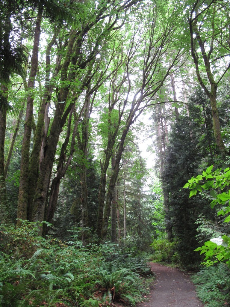
Nestled amid a quiet neighborhood of horse ranches and single-family homes, this 482-acre park has served largely as an equestrian recreation area since the 1950s. The winding, forested trails have also proven to be popular with other trail users, namely hikers, trail runners and dog walkers. Routes wind through a sea of second-growth trees standing at attention under which lush ferns carpet the forest floor.


The three main loop trails offer varying lengths of casual forest strolling: the mile-long Raven Trail, the interpretive Trillium Trail (1.7 miles) and the Coyote Trail (3.5 miles).

The minimal elevation gain also makes these trails extremely kid-friendly. All three loop trails start from a central junction just a short walk from the main parking area. The Coyote Trail starts in tandem with the Trillium Trail for the first half mile, then forks to the left at an intersection. It continues to loop the perimeter of the park, offering a good opportunity to stretch your legs and fully enjoy the park's flora and fauna.

Under western red cedar and other conifers, look for Oregon grape, spotted coralroot and Himalayan blackberry. A variety of birds—from hummingbirds to eagles— can be observed within the forest canopy. The Coyote Trail eventually loops back to the central junction and parking area, where you can explore the smaller loops or visit the horse training ring.

WTA Pro Tip: Work the trails in a clockwise direction so that the trail symbol signs face you throughout your hike. They’re only attached to one side of the posts and can be easy to miss if going the opposite direction.

Toilet Information

  • Toilet at trailhead
  • Accessible toilet
  • Toilet has running water

More information about toilets

Wheelchair Accessibility

Parking

  • Gravel parking lot
  • 2 marked accessible parking spots at north end of parking lot
  • Marked for parallel parking with access aisle between the spots and the rail fence

Restrooms

  • Located near the riding arenas north of the parking lot
  • Accessible stalls in both gender restrooms, but they are a tight fit for powerchairs
  • No unisex or family restrooms
  • Restrooms include a shower, not roll-in but do have fold-down benches, no hand-held shower heads

Other facilities

  • Both arena grandstands include raised wheelchair-accessible seating
  • Accessible drinking fountain
  • Wheelchair-accessible horse mounting platform located next to restrooms

Trillium Loop Trail

  • Trail surface is hard-packed dirt
  • Minimal cross-slope
  • Significant uphill grade leaving the parking lot through where the trail forks from the Coyote Trail. Most manual wheelchair users will need assistance due to the grade and distance.
  • Approximately a half-dozen 3- to 6-inch high steps due to water bars located sporadically around the loop
  • Likely accessible to most manual wheelchair users (with assistance), and some off-road style powerchairs

Raven Loop Trail

  • Trail conditions very similar to the Trillium Trail for most of the trail
  • Exception: The northernmost side of the loop. There is a ~200ft long, steep, uphill (when going clockwise) section, that has very loose soil surface. Additionally, the trail itself is in the bottom of a gully here, with no flat bottom, therefore always off-camber.
  • Due to the above, the complete Raven Loop Trail is likely inaccessible to most wheelchair users.
  • The unstable ground and steep slope may make it unsuitable for those with joint issues or those using other walking assistive devices (cane, crutches, etc).

[Accessibility notes provided by Z. K.]

Hike Description Written by
Kristen Sapowicz, WTA Correspondent

Bridle Trails State Park

Map & Directions

Trailhead
Co-ordinates: 47.6550, -122.1843 Open in Google Maps

Before You Go

See weather forecast

Parking Pass/Entry Fee

Discover Pass

WTA Pro Tip: Save a copy of our directions before you leave! App-based driving directions aren't always accurate and data connections may be unreliable as you drive to the trailhead.

Getting There

driving directions

From I-405 north, take exit 17, signed for NE 70th St. Turn right onto 116th Ave NE. At the NE 60th St stop sign, continue straight ahead to the park.

Take Transit

This trailhead is accessible by bus! Plan your visit by bus using TOTAGO, or consult the schedule for King County Metro RapidRide B Line, route number 221, route number 225, or route number 245.

More Hike Details

Trailhead

Puget Sound and Islands > Seattle-Tacoma Area

Washington State Parks

Guidebooks & Maps

https://www.parks.wa.gov/DocumentCenter/View/9278/Bridle-Trails-State-Park-PDF

You can improve or add to this guidebook entry!

Bridle Trails State Park

145 Trip Reports

Hiked here recently?

Submit a trip report!
 
Trip Reports